On Oct. 8, separate wildfires broke out in northern California, and since then, the number of individual blazes has grown to 21. As the fires spread, death tolls and missing persons numbers rise. According to the Washington Post, 31 people have been confirmed dead, making this the most devastating set of fires to hit the area.
Satellite images taken by DigitalGlobe show just how widespread the fires are, spanning over 191,000 acres, or roughly the size of New York City.
Our sister publication Marin Magazine is helping those affected by wildfires in California. Learn more about how you can join them in the recovering efforts. You can also donate to help the Red Cross provide relief services.
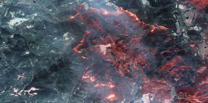
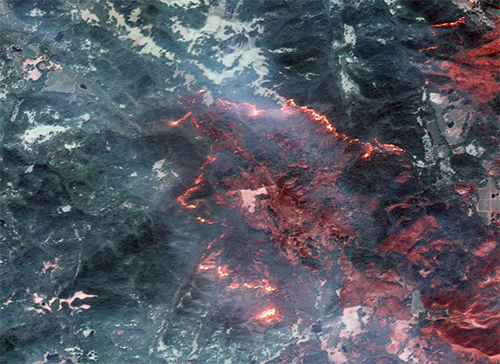
According to the DigitalGlobe website, the satellites were able to capture these photographs despite all of the smoke: “Although there is a lot of smoke in the area, shortwave infrared (SWIR) can penetrate the smoke and detect heat beneath.”
In some of these photos, you’ll see areas of red and areas that appear more gray and/or black. DigitalGlobe explained the difference in color to Business Insider noting that the grayish areas are one that have already been burned.
“Some of these are natural color, while others are shown in the Very Near Infrared (VNIR), where burned areas appear gray and black and healthy vegetation is red,” the company said in an emailed statement.
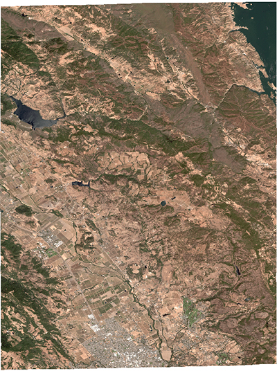
Here is the area before the fires started in these photos taken earlier this summer:
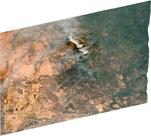
The fires started in a fairly small area:
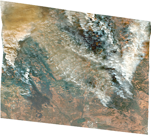
But since then, the smoke and flames continued to spread:
And once the fires were ablaze, they left a huge path in their wake:
After five days of the fires continuing to burn, CNN reports that the fire in Napa and Solano counties was only three percent contained, while the fire in Napa and Sonoma counties was 10 percent contained.
“We’re not even close to being out of this emergency,” Mark Ghilarducci, the director of California’s Office of Emergency Services told CNN.
The best ways to help victims of the Santa Rosa fires are through fundraising efforts, such as at the American Red Cross and GoFundMe. ABC 7 News also has a list of ways you can help, including donations to food pantries in the area.
Written by Augusta Statz for Simplemost.